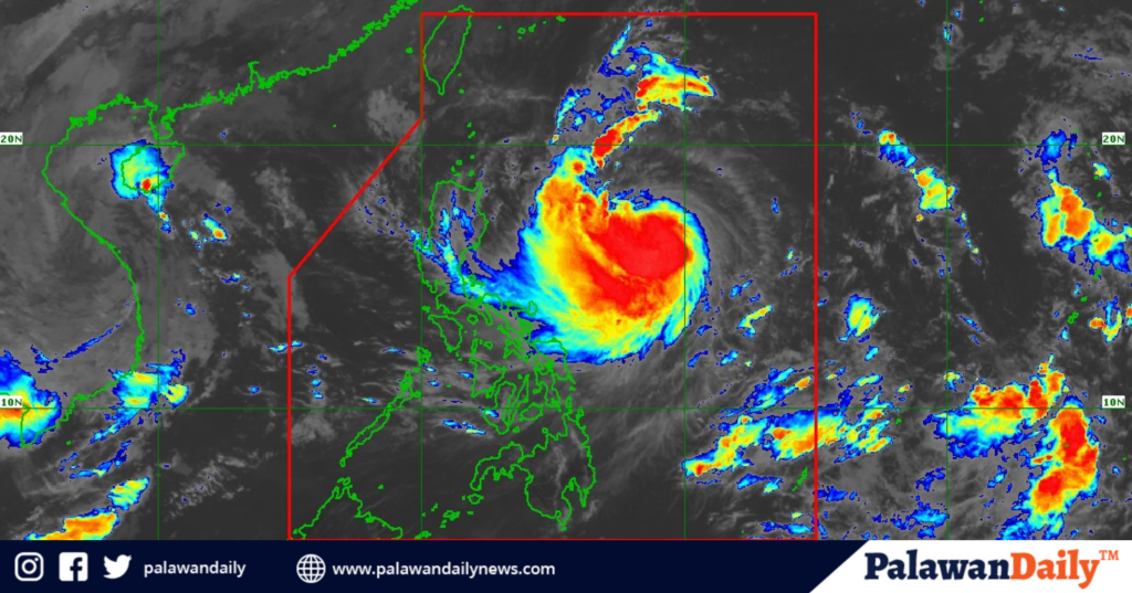
As Severe Tropical Storm Leon (international name: Kong-rey) rapidly intensifies over the Philippine Sea, residents of Palawan are advised to prepare for possible heavy rains, strong winds, flooding, and dangerous sea conditions that could disrupt travel and daily activities.
Forecasted to reach typhoon status within the next 24 hours, Leon poses an elevated threat to Palawan and other regions in Luzon and Visayas as it brings gusty winds and rain showers to coastal and low-lying areas.
Currently packing sustained winds of 95 kilometers per hour and gustiness reaching up to 115 kilometers per hour, Leon is predicted to continue strengthening as it moves toward the northern regions of the Philippines, potentially reaching super typhoon status when closest to Batanes.
This intensification raises the likelihood of Signal Nos. 3 or 4 warnings being hoisted in Northern Luzon, with areas such as Batanes possibly experiencing Leon’s strongest winds and rain.
PAGASA has placed several Luzon areas under Signal No. 1, including Batanes, Cagayan, Babuyan Islands, and other parts of Northern Luzon, with warnings of strong winds between 39 to 61 kilometers per hour within the next 36 hours.
Residents of these areas, particularly those in Palawan, are advised to brace for potential flash floods, landslides, and rough seas, with waves expected to reach heights of up to 5.5 meters along affected coastlines.
As Leon progresses, the effects of its outer rainbands are anticipated to bring gusty conditions to various regions, including Batangas, MIMAROPA, Bicol, Visayas, Northern Mindanao, and parts of the Caraga region. On Tuesday, October 29, gusty winds will likely extend to Aurora, Metro Manila, CALABARZON, MIMAROPA, and the Visayas.
These windy and rainy conditions are expected to persist through Wednesday, affecting other areas like Western Visayas, Negros Occidental, and Northern Samar.
The storm’s track suggests it may approach Taiwan’s eastern coast by Thursday night or early Friday, likely exiting the Philippine Area of Responsibility (PAR) by Friday morning or afternoon.
However, PAGASA has indicated that a slight westward shift could bring Leon closer to the Philippines than initially forecasted, leaving open the possibility of a close approach or even landfall in Batanes.
