

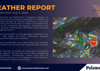
Residents of Palawan and parts of western Luzon are preparing for intensified rainfall as the southwest monsoon, locally known as the habagat, continues to strengthen.
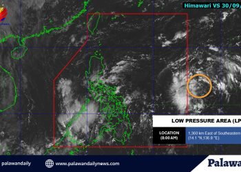
Pagasa Weather Specialist Chenel Dominguez reported that the LPA, currently about 1,255 kilometers east of northeastern Mindanao, is unlikely to develop into a typhoon in the short term.
However, its associated trough is already enhancing rainfall over parts of Eastern Visayas and Mindanao and is expected to increase the intensity of the habagat in affected regions.
Cloudy skies with scattered rain showers are forecast across Batanes, the Babuyan Islands, the Ilocos Region, Cordillera Administrative Region, Zambales, and Bataan due to the persistent habagat.
While typhoons often dominate headlines, the southwest monsoon remains a significant driver of seasonal weather in the Philippines, especially when strengthened by low-pressure systems like the current LPA.
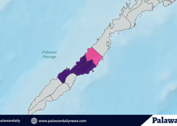
Communities in Palawan are urged to stay alert and monitor weather updates as authorities anticipate the continuing effects of the habagat compounded by the incoming low-pressure area.


